
By CAPT Donald M. Taub, USCG, Retired
On November 5, 1942, a U.S. Army Air Force [USAAF] Douglas C-53 Skytrooper with five men aboard returning from Iceland, reported that it had made a forced landing on the Ice Cap on the SE coast of Greenland somewhere south of the radio beacon station located at the village of Angmagsalik, Bluie East-2 (BE-2).
USAAF at the main airbase at Narsarssuak, Bluie West-1 (BW-1), called “O-No-To”, located near the southwest tip of Greenland, promptly began detouring aircraft, B- 17s, B-25s, C-47s, that were in transit from USA to Scotland, to search for the C-53. The B-17 “PN9E” was one of them.
The U.S. Coast Guard Greenland Patrol‟s (SOPA-USCG: RADM Edward “Iceberg” Smith) ships and its assigned U.S. Navy VP-93 PBY-5As had conducted the earlier aircraft search & rescues since the start of the trans-Atlantic flights via the “Snow Ball Route” that had begun on June 26, 1942, with three B-17 crashes on the first day; but were now busily engaged in other activities.
Winter was already beginning to set in, and daylight was getting shorter each day.
The establishment of additional sites on both coasts, including ship and air aids-to-navigation, weather stations as far north as Thule (BW-6), supplying the Sledge Patrol stations on the northeast coast, escorting Greenland convoys and conducting PBY anti-submarine patrols in the Greenland Air Gap continued during 1942. Following USCGC Northland’s rescue of the eight-plane “Lost Squadron” on the east coast on July 23, 1942, USCGC Comanche was sent to establish a USAAF weather-rescue station at that location. It was called “Beach Head Station” at Comanche Bay, located at 65° 04‟ North, about 85 miles southwest of BE-2. A small summertime weather observation shack was also added 17 miles due north on the Ice Cap at about 3,000 ft. elevation, called “Ice Cap Station.”
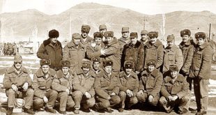
The abandoned eight planes of the “Lost Squadron” were about four miles due east of Ice Cap Station. The main station was a 16 ft. x 24 ft. wooden building and was outfitted with six small motorized sleds and 27 sled dogs. Its crew consisted of two officers (1LT Demorest & 2LT Eddy), seven enlisted men and a Norwegian civilian dogsledder, Johan Johansen. Meanwhile a new small airbase was being established about 90 miles northeast at Ikateq BE-2 called “Optimist”, near the weather and radio beacon station BE-2.
On November 6, the C-53 was in radio communications with Beach Head Station, and was told to fire flares. Its flares were seen twice on schedule that night, bearing due north and visually in line with closed Ice Cap Station, 17 miles due north. The station‟s CO, LT Max Demorest and SGT Donald Tetley set-out on two motorsleds with two other men (SGTs Hall and Linton) to man the radio at Ice Cap Station. On November 8, the C-53 was told to fire flares again, and the flares were seen bearing 350 degrees. The C-53 said that they could see the water. Due to the configuration of the coastline, this indicated that the C-53 was about five to 10 miles farther north. The Ice Cap there was essentially flat. On November 10, LT Demorest and SGT Tetley set-out toward the C-53 on their two motorsleds. LT Demorest reported his estimate that the rescue would be completed within three to four days; if the good weather continued.
But would it?
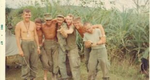
On November 9, the B-17 PN9E was sent out from BW-1, assigned to the search grid that encompassed the location of where the C-53‟s flares were seen, and the brief east-west coastline there. This coastline included three fjords. Comanche Bay fjord was the easterly one, and larger Koge Bay fjord was the westerly one. The B-17 had a six-man ferrying crew, and had picked-up a passenger , PVT Clarence Wedel, at Goose Bay, and two volunteer observers at BW-1 (TSGT Alfred Best and SSGT Lloyd Puryear).
The B-17 approached the approximate center of its search grid from seaward where it encountered a local low cloud ceiling. The B-17 reversed course to go around the weather and headed in again, going northward into Koge Bay fjord to the west, and flew into a visual “white-out”, which became an unseen three-sided trap. The pilot began to turn away to the left, and the left wing tip hit the unseen Ice Cap. The plane skidded for about 200 yards on the surface of the Koge Bay fjord‟s active glacier. The B-17 broke apart at the after bulkhead of the radio compartment aft of the wings. Volunteer observer, SGT Best was thrown out through the B-17‟s plexiglass nose. PFC Paul Spina was thrown out of the radio compartment across the left wing and broke his right arm. The three officers and the radioman were unhurt. Others suffered various cuts and bruises. The broken-off tail section was overhanging a large open crevasse, and another crevasse was in front of the plane. The B-17 was at about 4,000 ft. elevation and 29 miles northwest of Beach Head Station.
Fortunately the weather was good. They took stock of their situation, treated injuries, collected rations and made quarters in the cramped tail section of the plane. They used parachute shrouds to tie the two parts of the plane together, and used their parachutes for warmth. The three officers had been provided with jungle survival kits, each of which included a large bolo knife. These were later useful for cutting snow blocks to construct snow shelters. The radio compartment was badly damaged and doused with gasoline. The radioman made attempts to transmit SOSs using the portable 500 KC emergency radio with its kite antenna.
On November 10, the weather began to change. The snow lasted for three days. The motorsleds enroute to the C-53 were caught on the Ice Cap and had mechanical failures. And a RAF Douglas A- 20 Boston with a RCAF [Royal Canadian Air Force] three-man ferrying crew from Gander, Newfoundland, over flew its fuel stop at BW-1 in a snowstorm, and made a forced landing on the Ice Cap on the east coast. Its SOS was received at Gander. Now there were three planes on the Ice Cap on the east coast, and BW-1 was soon closed by the weather.
For the rest of the story, settle in for a read, complete with maps and photos, here.